Innovative Technologies Revolutionizing Modern Weather Forecasting
Discover how modern weather prediction relies on innovative technology like Doppler radars, radiosondes, ground stations, advanced data platforms, and satellites. These breakthroughs enable more accurate forecasts, early warnings, and better disaster preparedness, safeguarding communities worldwide in the face of climate change.
Innovative Technologies Revolutionizing Weather Forecasting Today
Progress in meteorological tech significantly enhances our ability to forecast weather accurately, especially as climate change impacts intensify. Cutting-edge tools enable real-time atmospheric data collection and analysis. Global networks of sensors and observation stations play a vital role in refining predictions. Here are five groundbreaking technological advancements transforming the landscape of weather prediction services presently.
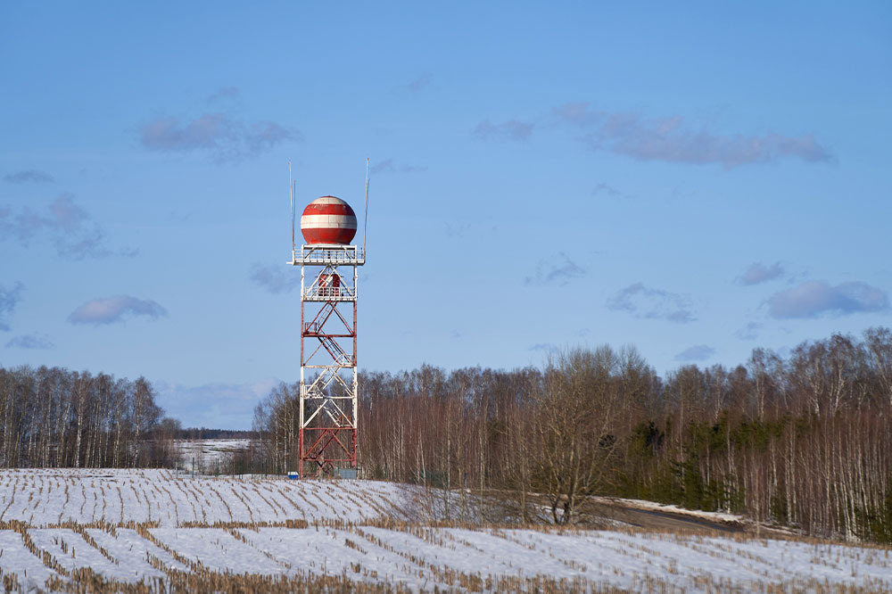
Doppler Radar Technology
Doppler radars emit radio waves that bounce off atmospheric particles, providing precise insights into their location and movement. These reflections reveal velocity and intensity of phenomena like storms, crucial for early detection. Enhanced with modern features, over 150 radar stations nationwide continuously monitor evolving weather patterns, especially in vulnerable coastal and inland regions.
Radiosondes for Atmospheric Data
Radiosondes are lightweight sensors carried by weather balloons that ascend to high altitudes, collecting data on wind, temperature, and humidity. They transmit info back to ground stations, aiding precise weather modeling. With over 75,000 balloons launched annually, radiosondes provide critical atmospheric insights necessary for accurate forecasting over broad regions. Their ability to function at extreme altitudes and cold temperatures makes them indispensable tools in meteorology.
Automated Surface Observation Systems (ASOS)
Developed jointly by the National Weather Service, FAA, and Defense Department, ASOS stations provide continuous, real-time weather data. They measure parameters like cloud cover, precipitation, wind, and pressure at key locations, supporting both daily forecasts and aviation safety. Operating 24/7, ASOS enhances forecast precision and disaster preparedness initiatives.
Advanced Weather Data Platforms (AWIPS)
AWIPS is an advanced system that integrates atmospheric data from radars, radiosondes, and surface stations. Utilizing high-capacity servers and satellite links, it processes large datasets with sophisticated algorithms, creating detailed weather models. This system enables meteorologists to produce accurate forecasts and facilitates seamless data sharing among national prediction centers.
Earth-Orbiting Weather Satellites
Satellites positioned over 22,000 miles above Earth provide essential high-resolution images and atmospheric information, including moisture and cloud data. They offer frequent updates crucial for tracking storms and climate changes. Satellite observations deliver a comprehensive view of weather systems, supporting timely alerts for severe weather events and aiding long-term climate analysis.
By integrating these advanced technologies, meteorologists worldwide can detect even subtle atmospheric variations. This proactive approach ensures early warnings for storms and natural disasters, ultimately protecting lives and property through improved prediction and readiness strategies.